DRONE DIAGNOSTICS & AI
DRONE AND AI DIAGNOSTICS: A 360° VISION OF YOUR CROPS FOR PRECISION AGRICULTURE
AGREEGO offers a multidimensional analysis of your plots. By combining drone technology, multispectral sensors and artificial intelligence, we transform aerial imagery into actionable data. Optimise every step of your technical itinerary through proactive, sustainable and profitable management.
WHY CHOOSE DRONE DIAGNOSTICS?
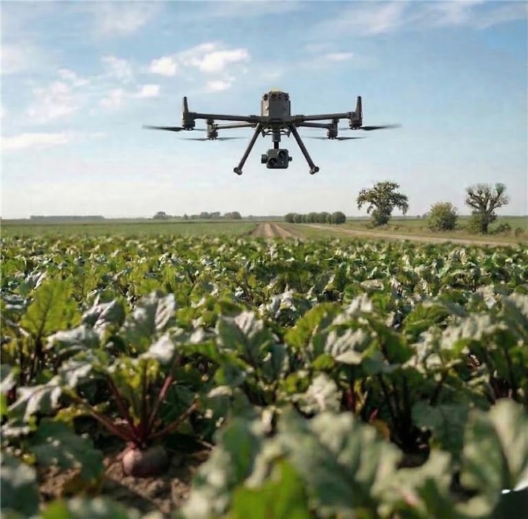
Aerial drone detection offers advantages that no conventional observation can match. It allows you to cover vast areas in record time while identifying issues invisible to the naked eye through spectral analysis.
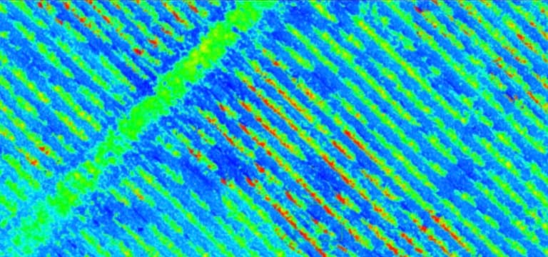
OUR DRONE & AI DIAGNOSTICS: WEED DETECTION, NDVI ANALYSIS AND NDWI MAPPING
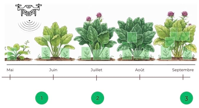
AI Weed Detection
Our AI software from AGREEGO LAB ensures dual verification (shape + colour) for maximum reliability. Precisely identify species and infested zones for targeted interventions.
Leaf Vigour (NDVI) — A Global Monitoring Tool
The NDVI diagnostic is essential for all your crops (maize, wheat, rapeseed, potato, etc.). It measures biomass and photosynthetic activity in your plots. It is the ideal tool for:
- Modulating your nitrogen inputs according to the real needs of each zone.
- Monitoring growth and early identification of disease or deficiency hotspots.
- Optimising your yields by intervening at the right place, at the right time.
Water Stress (NDWI)
Anticipate the water needs of your crops before signs of wilting become visible. The water stress diagnostic allows you to manage your irrigation with precision and secure your yields during drought periods. For real-time monitoring, we also install permanent connected probes. This data, combined with weather forecasts and soil water content, provides personalised irrigation advice, directly accessible on our AGREEGO Cloud platform.
Frequently asked questions about drone & AI diagnostics
- NDVI (Normalized Difference Vegetation Index) is an index calculated from multispectral images captured by drone. It measures the leaf vigour of crops by comparing red and near-infrared wavelengths. A high NDVI indicates dense, healthy vegetation; a low NDVI reveals stress or an anomaly to be treated.
- The drone flies over the plot and captures ultra-high-resolution images. Our artificial intelligence analyses each zone, identifies and locates weeds, then generates a weed presence map. The farmer can thus target their weeding and significantly reduce their herbicide consumption.
- NDWI (Normalized Difference Water Index) is a multispectral index that detects the water content of plants and soils. It allows water stress zones to be identified in a plot even before wilting symptoms are visible to the naked eye, so that irrigation can be adapted accurately and economically.
- Drone diagnostics replace partial ground observations and systematic treatments applied to an entire plot. By accurately mapping the real state of the crops — weeds, vigour, water stress — it enables targeted interventions that reduce costs, inputs, and environmental impact.
THE AGREEGO ADVANTAGE: PROPRIETARY AI AND INTEGRATED CLOUD PLATFORM
EXPERTISE AT THE SERVICE OF PERFORMANCE
PROPRIETARY AND ADAPTABLE ARTIFICIAL INTELLIGENCE
Our AI is adaptable to your crops (sugar beet, potato, maize, etc.) and your specific needs. It transforms complex images into simple, actionable prescription maps.
SIMPLIFIED MANAGEMENT VIA AGREEGO CLOUD
- Fast results: Your diagnostics are available within 5 working days on our secure platform.
- Total compatibility: Data provided in formats directly usable by your tractor or sprayer consoles.
- Serenity and Simplicity: A historical tracking of your plots to measure the effectiveness of your interventions year after year.